Lake News Alerts
We'd like to send you lake news articles, videos, and podcasts from around the web.
 We will never share your email
|
Catawba River
|
|
Length: 220 miles (354 kilometers)
The Catawba River (kuh-TAW-buh)in North Carolina and South Carolina rises in west McDowell County of west North Carolina in the Blue Ridge Mountains south of Mt. Mitchell, east of Asheville. It flows east through Lake James reservoir, Lake Rhodhiss reservoir, Lake Hickory reservoir, turns south into the Lookout Shoals reservoir, through Lake Norman reservoir to west of Mooresville (formed by Cowans Ford Dam), through Mountain Island Lake reservoir, then flows between Charlotte and Gastonia, North Carolina, and through Lake Wylie reservoir where it forms North Carolina-South Carolina state line for approximately 7 miles, continues into South Carolina, then flows past Rock Hill and through Fishing Creek reservoir. It then enters Lake Waters reservoir and becomes Water River. South Fork Catawba River, in west central North Carolina is formed by the joining of Henrys Fork and Jacobs Fork rivers,and flows to the Catawba River in the Lake Wylie reservoir.
CATAWBA RIVER LAKES
|
|

|
The lake also supports Riverbend Steam Station by cooling the steam that drives the turbines and provides a dependable water supply for Mount Holly, Gastonia and Charlotte-Mecklenburg, North Carolina.
Mountain Island Lake is a lake northwest of Charlotte, North Carolina created in 1924 to coincide with the building of Mountain Island Hydroelec...


Full Pool: 647.5 MSL
Area: 3,281 Acres
|
|
|

|
About the Lake
Fishing Creek Reservoir is located on the Catawba River approximately 9 miles southeast of Lancaster, SC. Considered a "run-of-the-river" lake, its size is approximately 3,431 surface acres with little storage capacity. Heavy amounts of floating debris are frequent and numerous shallow water areas can make boating hazardo...
Full Pool: 100.0 Datum
Area: 3,431 Acres
|
|
|
|
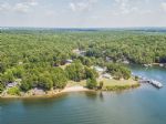
Lake Wylie is a reservoir, or man-made lake in the U.S. states of both South Carolina and North Carolina. The lake has a surface area of 13,400 acres and features 325 miles of shore line.
Lake Wylie's location on both the South Carolina and North Carolina borders makes it a common recreational destination for residents of nearby cities including C...
|
|
|
|
|
Lake James is a large reservoir in the mountains of Western North Carolina which straddles the border between Burke and McDowell Counties. Lake James is named for James B. Duke, one of the founders of Duke Energy. Lake James has a surface area of approximately 6,812 acres, with 150 miles of shoreline. Full pond elevation is 1,200 feet.
Built over...
|
|
|